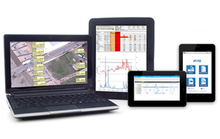
Autodesk Geotechnical Module for AutoCAD Civil 3D
Press Releases

New AutoCAD Civils 3D Geotechnical Module boosts usability

Autodesk Geotechnical Module for AutoCAD Civil 3DAutodesk’s Geotechnical Module for AutoCAD Civils 3D 2017 makes it even easier to integrate and visualise geotechnical data within AutoCAD and enables improved collaboration between project teams working with BIM.

The module, developed for Autodesk by AEC Geotechnical Industry Partner Keynetix, has been completely updated for the 2017 version of AutoCAD Civils 3D. Free to download to existing users, it features a number of enhancements to improve usability.

[Editor] Click through for the rest of the press release from GeoPrac.net sponsor Keynetix [/Editor]

[…]

Lab Scheduling Press Release atmis
Press Releases

Latest Release of HoleBASE SI Transforms Laboratory Scheduling

Lab Scheduling Press Release atmisRedditch 30th Jan 2015 – The new release of HoleBASE SI includes ‘scheduling tools’ that allow engineers to electronically schedule geotechnical or environmental testing. This major breakthrough is likely to transform the way consultants and laboratories communicate with each other over the coming months.

The new improvements also provide a glimpse of how well integrated customers and laboratories can be with the first UK wide implementation of a web service connection to ALcontrol’s @mis online laboratory data management system. . This unique development allows customers to schedule testing directly into the @mis system using data and tools inside of HoleBASE SI and then be notified within HoleBASE SI when the testing is completed.

[Editor] Click through for the rest of the press release from GeoPrac Sponsor, Keynetix [/Editor]

[…]

Keynetix_Geotechnical_Academy_1
Press Releases

Keynetix to Support the Geotechnical Academy

Keynetix are delighted to have been offered the opportunity to be a regular contributor to the Geotechnical Academy starting in June 2014. The Geotechnical Academy is a collaboration between Equipe Group and Geotechnical Engineering Ltd, […]

No Picture
Press Releases

URS purchase unlimited usage ESdat Licence

URS will use ESdat to manage laboratory and field data related to groundwater, contaminated site, and other environmental projects.

URS (Australia/New Zealand) and EarthScience Information Systems (EScIS) are pleased to announce the purchase of an unlimited usage ESdat Licence by URS for its Australian and New Zealand Offices.

URS will use ESdat to manage laboratory and field data related to groundwater, contaminated site, and other environmental projects.

[Editor] Read on for the rest of the press release from EScIS and ESdat [/Editor]

[…]

Environmental_Data_Management_for_Site_Holders_img_0
Articles

Environmental Data Management for Site Holders

Many site-holders engage a variety of consultants, laboratories, and in-house staff to collect, manage and report their environmental data.

Unfortunately this often results in data being trapped in various pdf reports, GIS layers, emails, excel workbooks, or even in hard copy. This data becomes increasingly difficult and time consuming to manage and retrieve as more data is collected and as legislative reporting requirements become more rigorous.

[Editor] Click through for the rest of this interesting article. [/Editor]

[…]